Meishan Visitor Center Exhibition Room
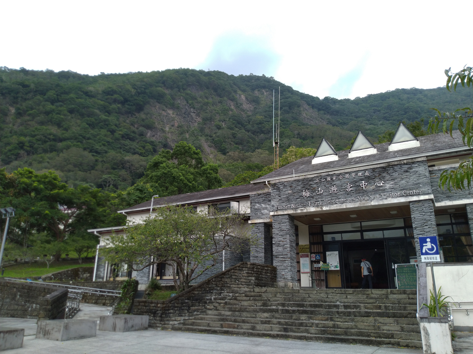
Meishan Visitor Center
The entrance to the southern recreation area of the Yushan National Park is the Meishan Visitor Center. After entering Meishan, visitors enter the southern area of the Yushan National Park, which covers major scenic spots along the Southern Cross-Island Highway, such as Liguan, Zhongzhiguan, Tianchi, Kuaigu, and Yakou. To provide visitors with a better conceptual understanding of the highlights of the area before entering the park and to provide more flexible interpretation services, the Visitor Center is mainly divided into two exhibition areas, and Exhibition Area 1 is mainly a self-guided fixed tour design with a small number of DIY interpretations by on-site personnel, including the past and present life of the formation of Yushan, the introduction of rock formations and geology along the Southern Cross-Island Highway, the rich biodiversity of the fog forest zone, the opening of the Highway and the history of the construction of the Guanshan Historic Trail, the story of Typhoon Morakot, hiking safety, etc. In addition to the Visitor Center, Meishan also features another building, the Bunun Cultural Heritage Exhibition Hall, which introduces the history of migrations of the Bunun people, seasonal rituals, and daily life, revealing the inseparable bonds between the Bunun and Yushan National Park.
The Past and Present of Yushan
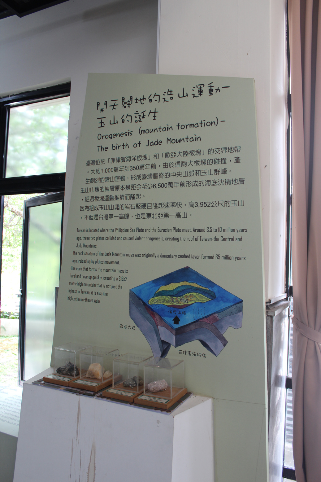
The Past and Present of Yushan
Yushan, also known as Mount Jade, is the highest peak on Taiwan Island and in Northeast Asia. This area provides a brief introduction to how Taiwan was pushed out of the sea hundreds of millions of years ago and how the five mountain ranges were formed as a result of the continuous collision and compression of the Eurasian Plate and the Philippine Sea Plate and the continuous mountain-building events through orogeny.
The Geology and Mountain Ranges of the Southern Cross-Island Highway
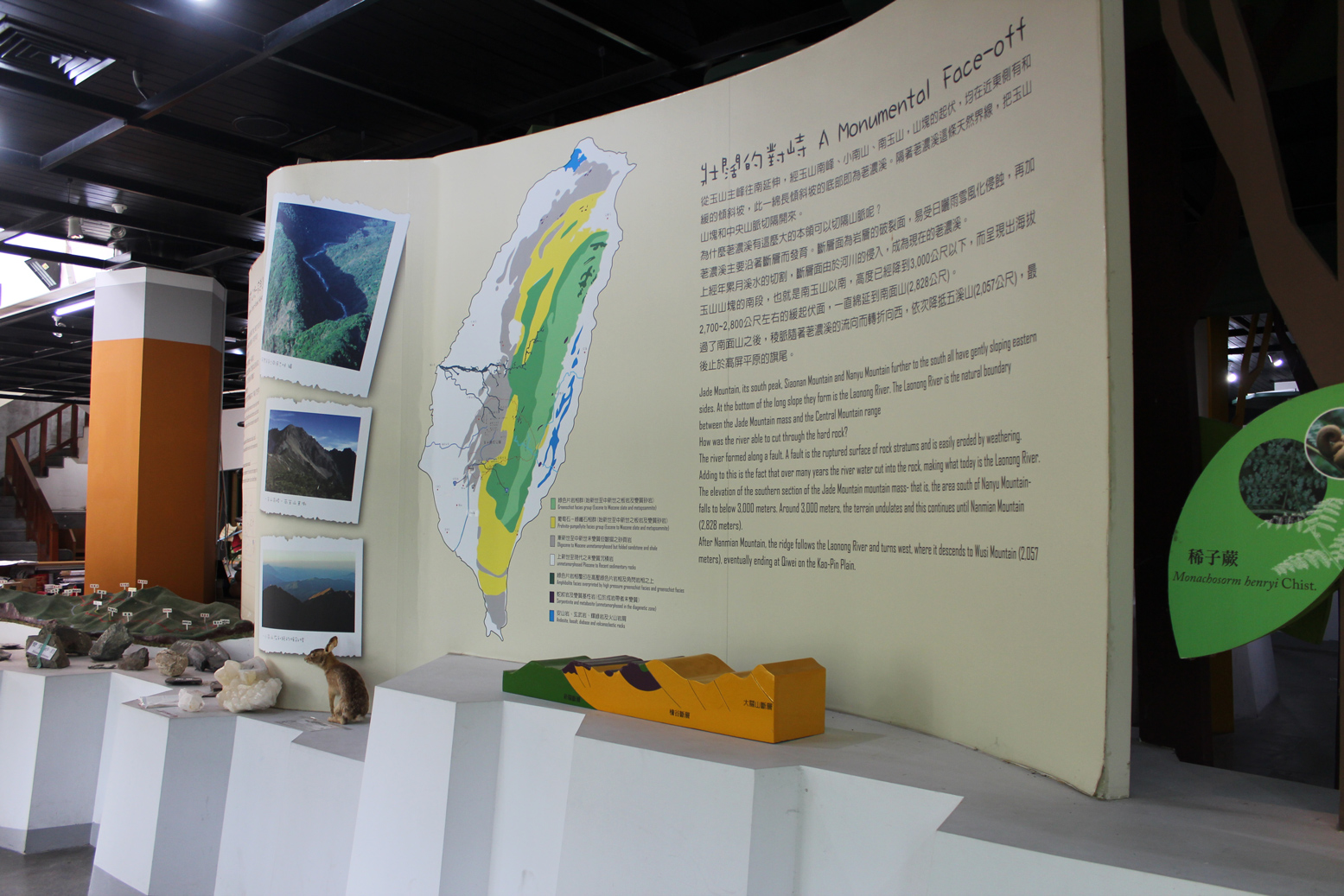
The Geology and Mountain Ranges of the Southern Cross-Island Highway
Because of the constant mountain-building geological movement, 70% of Taiwan’s land mass is mountainous. From the elevation of 1,014 meters in Meishan to the highest point of the highway, at 2,722 meters in Yakou, the geology is mostly formed by metamorphic rocks, and the degree of metamorphism is shallow to deep, with the age of the strata gradually getting older. The route includes many mountains over 3,000 meters, including the 3,668-meter Guanshan, with the highest peak in Southern Taiwan, as well as Taguan Mountain, Kuhanuoxinshan, Guanshan-Lingshan, Guanshan North Peak, and Yingzizuishan.
Guanshan Historic Trail and the Southern Cross-Island Highway
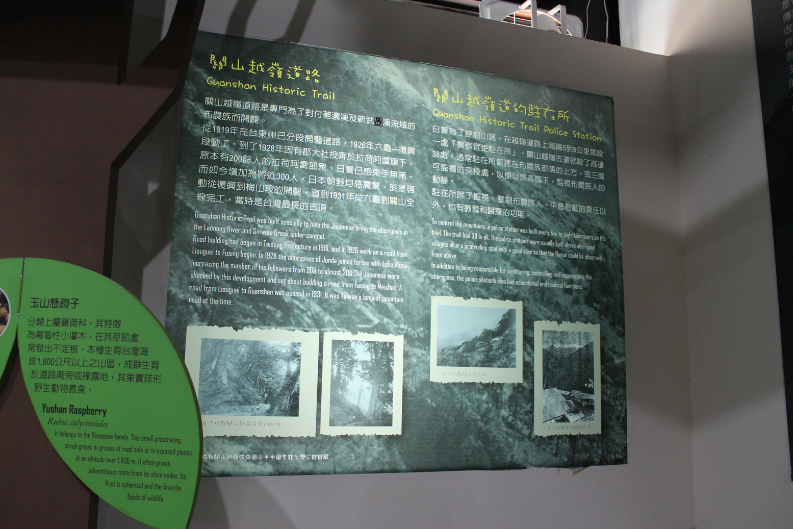
Guanshan Historic Trail and the Southern Cross-Island Highway
The Guanshan Historic Trail is the longest road in the mountainous area built during the Japanese rule of Taiwan. It crosses the Central Mountain Range from Liugui in Kaohsiung to Guanshan Township in Taitung and is 171.06 kilometers long, and was used to monitor the activities of the Bunun people in the mountainous areas. The Zhongzhiguan Police Post was the largest in the western section at that time, with a roster of 30 officers. The Zhongzhiguan Trail is the most well-preserved section of the park, and is located above the Southern Cross-Island Highway connecting the two ends of Tianchi and Zhongzhiguan, providing the public with an opportunity to access the natural and cultural heritage of the site. The Southern Cross-Island Highway, which was completed in 1972, roughly follows the historic trail and merges with part of it. Initially constructed for military defense and logistics purposes, only later did it serve the purpose of tourism and recreation.
Biodiversity of the Fog Forest Zone
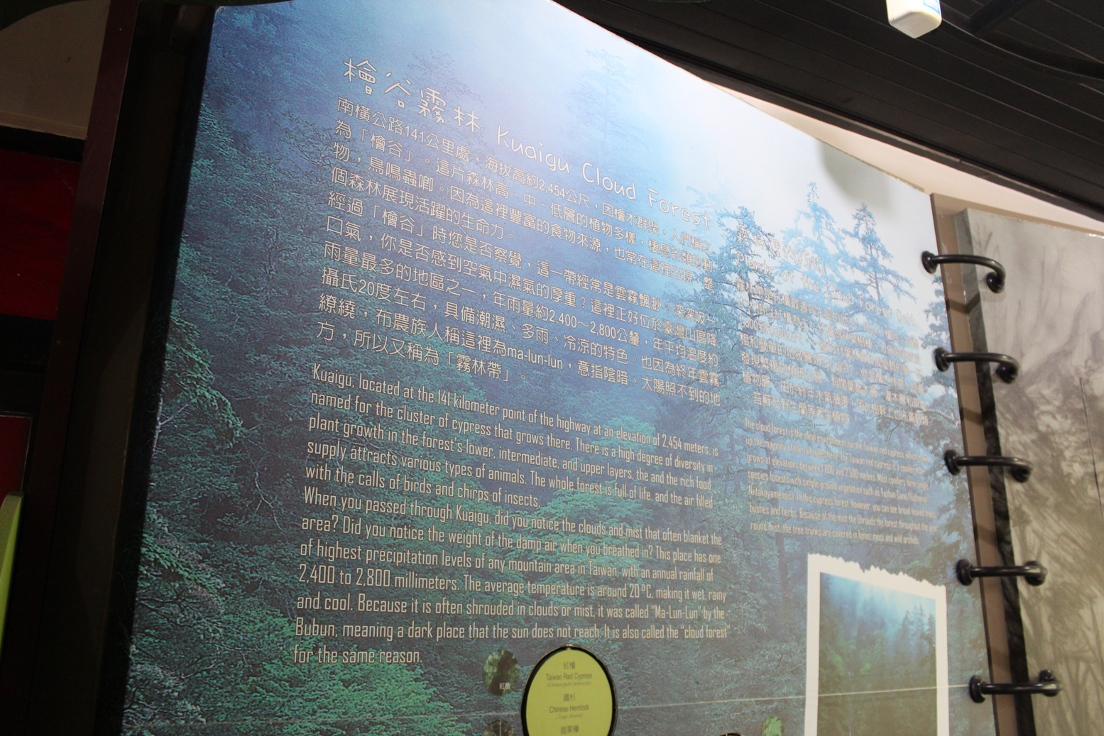
Biodiversity of the Fog Forest Zone
The mountainous areas of Taiwan at an altitude of 1,800 meters to 2,500 meters is the area with the most rainfall and the richest biodiversity. Because of the water retention and the topographic effect of the mountainous area, clouds and fog surround the area all year round, thus it is also known as the Fog Forest Zone, which has the characteristics of humidity, frequent rain and cool temperatures. The area extending from Zhongzhiguan to Kuaigu along the Highway is located in this zone, which features an abundance of mixed coniferous forest with tall majestic trees, medium and low level shrubs and grass, forming a multi-layered biological network and rich biodiversity.
Bunun Cultural Exhibition Center
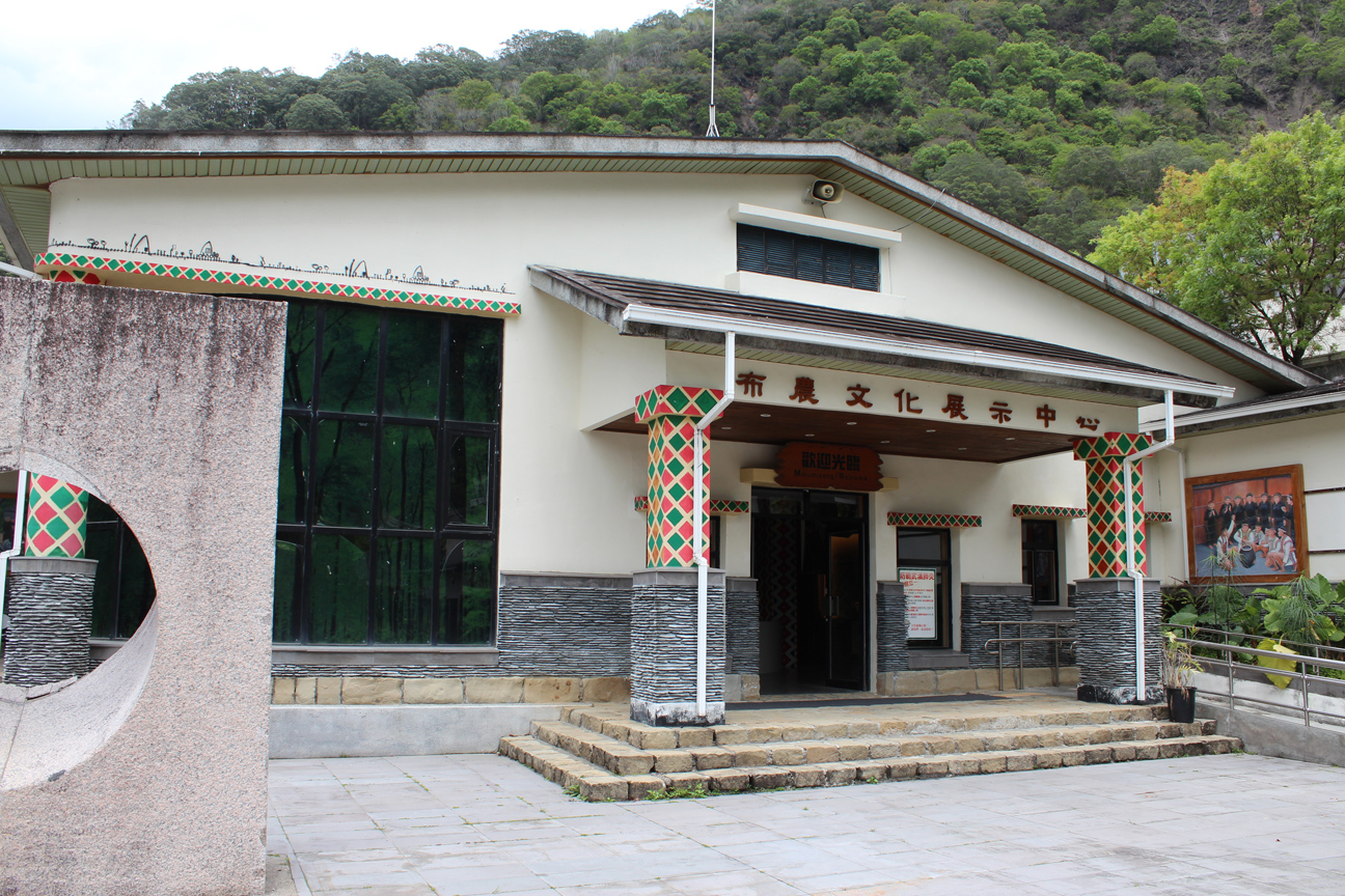
Bunun Cultural Exhibition Center
When entering the Southern Entrance of the Yushan National Park, one enters the traditional communities of the Bunun people. Bunun culture is presented in two methods to visitors to allow for a better understanding.
Bunun Migration History
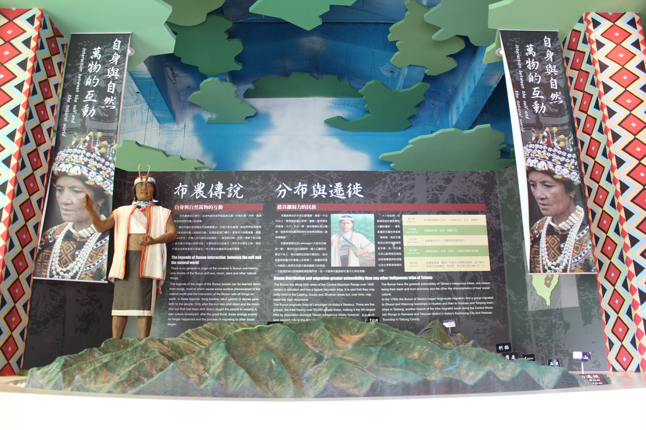
Bunun Migration History
The Bunun live in the Central Mountain Range, which is over 1,000 meters above sea level, and are a typical alpine ethnic group. They are also known as one of the most widely dispersed indigenous peoples of Taiwan. There are six major communities: the Take-todo community (around Ren’ai and Wujie Township), the Take-bakha community (Tannan, Dili, Shuanglong), the Takivatan community (Dili), the Takebanuad community (Nantou, Hualien, Taitung), the Isbukun community (Nantou, Taitung, Kaohsiung), and the Takopulan community (formerly known as Takipulan. Mostly in Nantou, with a lesser population).
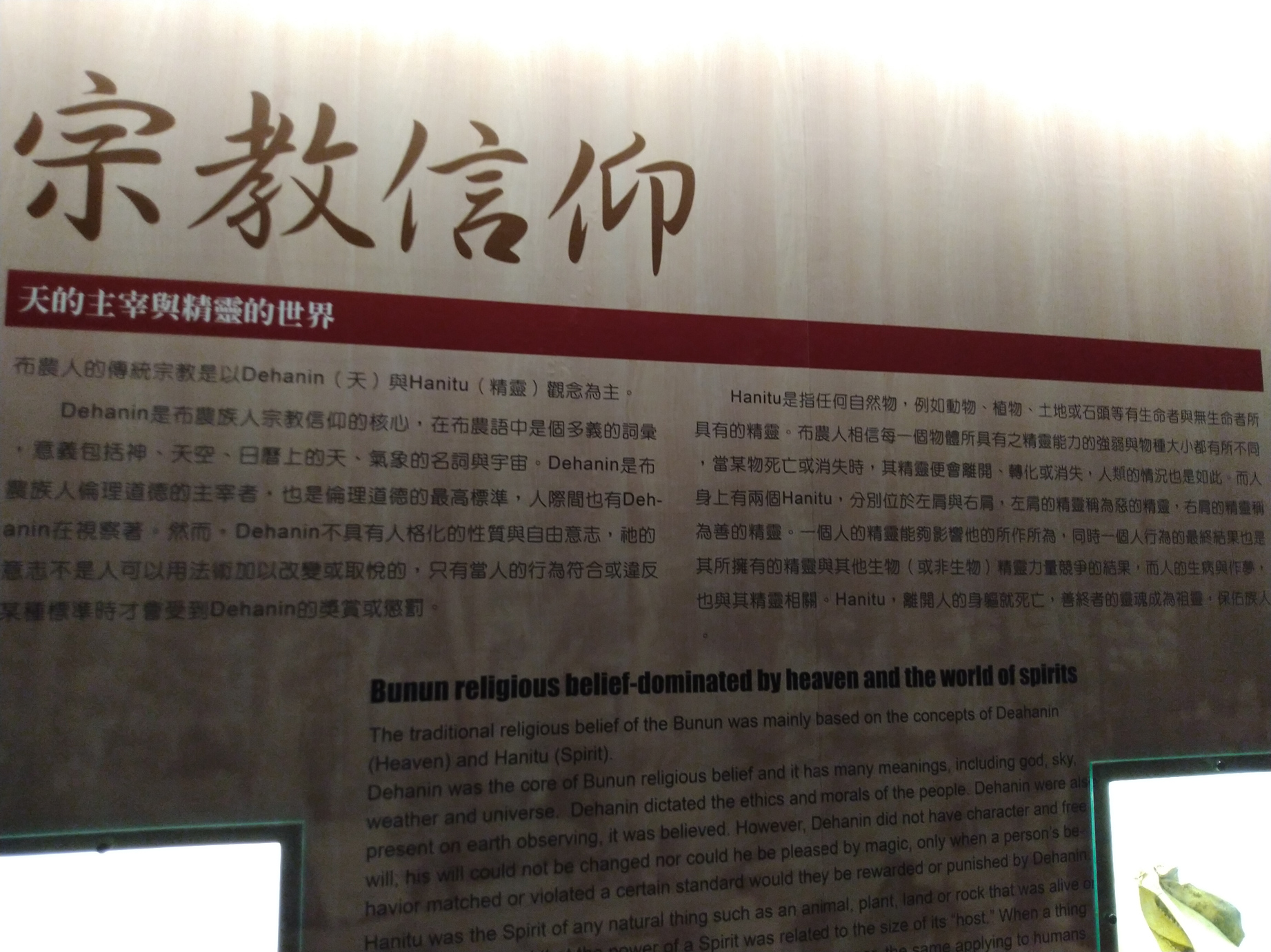
Bunun Beliefs
Bunun traditional beliefs are based on the spirit hanitu, which refers to the spirits of animals, plants, spirits, and other natural objects, each of which has its own unique inner power.
Bunun Lifestyles
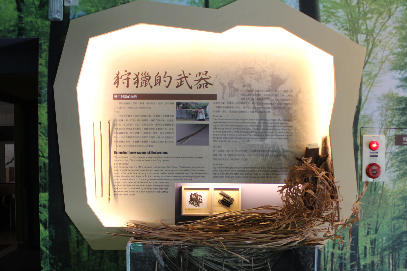
Bunun Lifestyles
The Bunun people have been living in the central mountain range for many years, and their traditional life basically revolves around the agricultural production method of mountain field swidden farming. Members often travel through mountains in pursuit of animals, which is supplemented by hunting and gathering, so the purpose of hunting is meat consumption and animal hides.

