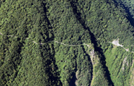
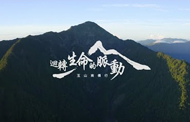
玉山群峰步道系統
本日開放南二段步道系統
本日開放八通關越嶺步道系統
本日開放馬博拉斯橫斷步道系統
本日開放新康橫斷步道系統
本日開放南橫公路梅山口-天池-埡口-向陽段(台20臨105線)
部分開放塔塔加遊客中心-新中橫公路南投信義端(台21線)
部分開放塔塔加遊客中心-新中橫公路嘉義端(台18線)
本日開放南安遊客中心-玉長公路(台30線)
本日開放水里遊客中心(台16線)
本日開放梅山遊客中心-南橫公路高雄端(台20線)
本日開放
氣溫
-降雨率
-
南橫公路附近海拔超過 3,000 公尺以上的百岳,由庫哈諾辛山、塔關山及關山嶺山總稱為「南橫三山」,其登山口均位於南橫公路沿線上。登山口方便抵達,但路線多為陡上且部分路段須拉繩上攀,在國家公園步道系統...
查看更多
「向山啟程,留守才是第一步!」內政部營建署邀請到金鐘演員連俞涵擔任登山安全守護天使,從登山啟程、意外發生、留守人及登山隊員的通力合作、到最後救援成功,以一場有驚無險的山域意外事故強調留守制度的重要性。...
查看更多
|登頂全臺最⾼峰,看完影片再出發!| ⽟⼭是國內外⼭友的熱⾨登⼭路線,兩天⼀夜的⾏程可將⽟⼭主峰與⽟⼭⻄峰⼀併安排,並依據個⼈能⼒與時程評估是否登頂⻄峰。若平時少有登⼭經驗、⼜缺乏運動習慣,⼀...
查看更多
|登頂全臺最⾼峰,看完影片再出發!| ⽟⼭是國內外⼭友的熱⾨登⼭路線,兩天⼀夜的⾏程可將⽟⼭主峰與⽟⼭⻄峰⼀併安排,並依據個⼈能⼒與時程評估是否登頂⻄峰。若平時少有登⼭經驗、⼜缺乏運動習慣,⼀...
查看更多
登山迷途莫驚慌,謹記STOP保命原則,讓自己安全下山。 Stop: 停止前進 Think: 回想過程 Observe: 觀察環境 Plan: 擬定待援計畫
查看更多
跟著詹喬愉 - 三條魚Tri Fish 認識高山症的種類、高山症的黃金定律和預防方法, 出發前可先前往高山旅遊門診諮詢,遵循醫師指示,預為準備,量力而為。
查看更多